Subject to satellite availability.
By the way Laura, this image may show black during the day in the UK (this will be because where we are it will be night time and dark).

Image refreshed every 60 seconds
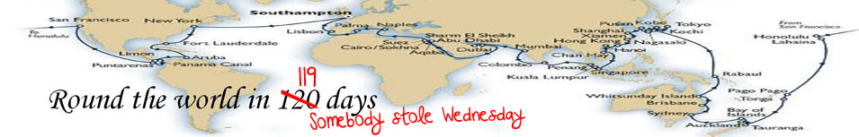
Current Position
Subject to MarineTraffic data feed.
You are able to zoom in and out on this screen to see our current position. The options in the top right hand corner allow you to select Street Map, Satellite Imagery and Plain Map views. Hover the cursor over other nearby vessels and click when a question mark appears, this should reveal full details of that particular vessel (remove details by clicking on ‘X’ in top righthand corner of panel). Click and drag to recentre the map when zooming in and out.
Http iframes are not shown in https pages in many major browsers. Please read this post for details.